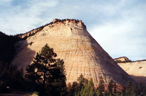
Checkerboard Mesa, Zion National Park.
Day-by-Day |
|
| Introduction | |
| Travel | |
| Zion National Park | |
| Bryce National Park | |
| Zion National Park | |
| Coral Pink Dunes, Cedar Breaks and the Vermilion Cliffs | |
| Grand Canyon North Rim | |
| Antelope Canyon and Lake Powell | |
| Navajo National Monument, Monument Valley, and Natural Bridges | |
| Arches National Park | |
| Canyonlands National Park | |
| Arches and the Drive to Park City | |
| Utah Olympic Park | |
| Park City and Olympic Cauldron Park | |
Other Links |
|
| 2002 Winter Olympics | |
| 2001 Europe | |
| 1999 Australia | |
| Home Page | |

Monday morning we followed Arizona Route 9 through the rest of Zion Canyon. The road is on Park property, and can only be traveled by paying the park entrance fee or with a Park pass. We left fairly early in the morning, so were able to see the sun rising across the cliff faces as we drove and stopped for photographs. The road is quite a feat of engineering, with switchbacks hugging the cliff faces. A mile-long tunnel takes the road just behind one sheer cliff face, with windows carved into the rock every quarter mile or so to let in some light. (Ken wondered if these were intentional or accidental fracturing of the walls when an unexpected weak section of rock gave way to the outside.) One of the more interesting cliffs was Checkerboard Mesa, a cliff that had remarkably regular horizontal and vertical fissures running across its entire face.
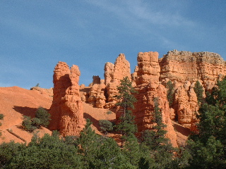
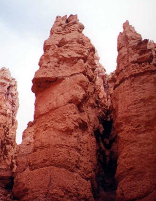
We joined up with US 89 in Mt. Carmel Junction and took it north about 45 miles, then got on Route 12 east to Bryce's visitors center. As soon as we turned onto Route 12, we got our first look at hoodoos, the rock formations for which Bryce is famous. Cliffs first erode into long fins, vertical sections of rock lined up in parallel. Then, the rock erodes from the end of the fin, leaving vertical, almost cylindrical, towers.
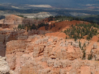
Having had such great luck with the shuttle buses in Zion, we parked at the visitors center and took the bus into the park and rode the shuttle first to Bryce Point, the end of the shuttle system. The view back up the canyon was spectacular. Bryce's shuttles were not quite as convenient as Zion's, and we somewhat regretted the choice of leaving our car behind by later in the day. The shuttles only run in one direction in an endless loop, not as frequently (every 15-20 minutes), and the distances are far greater between stops.
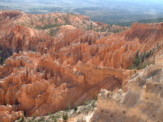
Our next stop was the lodge at Sunset Point, from which we walked along the canyon rim to Sunrise Point. There's a small store there to support visitors and campers; we bought our lunch and ate it on the deck facing the canyon. After lunch, we walked the Queen's Garden Trail down into the canyon. A fairly steep path led about 320 feet down into the canyon along a mile-long path.
As we descended, we heard the occasional clap of thunder, but couldn't see the clouds particularly well. By the time we descended to the base of the trail, though, we could see black clouds overhead and could see lightning flashes, about 10-12 seconds away. Since we were deep in the canyon, there was no way to go but up. We elected to take a less exposed route up, along the Navajo Loop trail. Inadvertently picking the down pathway to ascend, we walked against traffic (not that many people) up the Wall Street canyon.
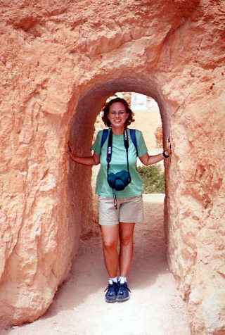
Wall Street was truly inspiring: narrow pathways between several hundred foot-tall rock hoodoos. It did not rain on us, though, until we were safely on the canyon rim.
Having returned to the summit, we rode the bus back to the parking lot to get our car so we could explore the southernmost points of the park (the shuttle system does not run to Rainbow and Yavimpa points, about 12 miles farther south along the rim road. The views from here were beautiful, but not as spectacular as in the upper part of the canyon.
Having explored the park, we drove back south to Zion, retracing our steps. Dinner was at the Spotted Dog Cafe.