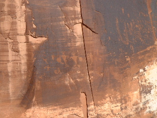
Petroglyphs along Potash Road.
Day-by-Day |
|
| Introduction | |
| Travel | |
| Zion National Park | |
| Bryce National Park | |
| Zion National Park | |
| Coral Pink Dunes, Cedar Breaks and the Vermilion Cliffs | |
| Grand Canyon North Rim | |
| Antelope Canyon and Lake Powell | |
| Navajo National Monument, Monument Valley, and Natural Bridges | |
| Arches National Park | |
| Canyonlands National Park | |
| Arches and the Drive to Park City | |
| Utah Olympic Park | |
| Park City and Olympic Cauldron Park | |
Other Links |
|
| 2002 Winter Olympics | |
| 2001 Europe | |
| 1999 Australia | |
| Home Page | |

A relatively quiet day for us today, at least in comparison with previous days. We got a slightly later start than has been our habit and headed up route 279, the Potash Road. This scenic road follow the Colorado River downstream through its canyon in the direction of Potash, a mining town, beyond which it is only navigable by four wheel drive vehicles. We didn't go quite that far, though. Aside from its natural beauty, the road is notable for the petroglyphs visible in the rock at several points 20-25 feet above the roadway. Petroglyphs are carvings etched into the rock (there are also pictograms, which are painted onto the rock, not carved). Some of the petroglyphs were made between 600 and 1300 AD; more recent carvings were made much closer to the present. Of course, much more modern graffiti covers some of the walls, alarmingly close to these much older markings. Who knows what future generations will make of our scratchings?
At one other stop there were remnants of a significantly older sort -- dinosaur footprints. The slab of rock on which they were preserved lies about 20 feet above the road.
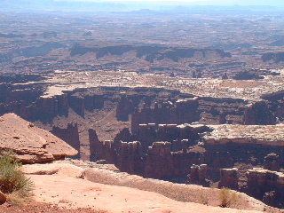
After returning to the main road the way we came, we continued north toward Route 313, leading into Canyonlands National Park. Significantly less crowded than Arches, Canyonlands occupies three levels of a plateau -- the "Island in the Sky," the top of the mesa that we visited, the Maze, lower down, and the Needles, along the Colorado River. We headed directly for the farthest south point reachable by road from the north -- Grand View Point Overlook. From this overlook, we took a mile-long hike to the west along the canyon rim. The drop off to the next plateau was significant -- about 1200 feet almost straight down sheer Navajo sandstone cliffs. The views were incredible, though, with the Colorado and Green Rivers visible in the middle distance between canyon walls.
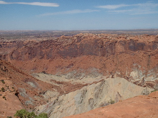
After making our way from the lookout point back to the car, we drove to a nearby picnic area for our lunch (purchased at City Market, a grocery store in Moab). Our second Canyonlands stop was at Upheaval Dome, about 12 miles north of our lunch area. This short hike (.25 mile each way) took us to a precipice overlooking a two mile-wide crater with a small peak in the center. Two conflicting theories exist about the origins of this crater. One says it is a product of a thick layer of salt squeezed by rock above it until it rose to the surface, pushing aside layers of sedimentary rock as it was elevated. The second says that it is the result of a meteor impact some 65 million years ago. The latter strikes us as being more interesting and better accounts for the complete disruption in sedimentary layers around the crater rim, but we'll leave final resolution to the geologists.
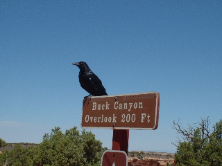
At the Buck's Canyon Overlook, a large, talkative raven stood guard. We're sure he was only interested in tourist leavings that didn't make it into the trash barrels, but his presence was eerie enough to make us wonder whether he expected us to plummet to our deaths on the canyon floor below.
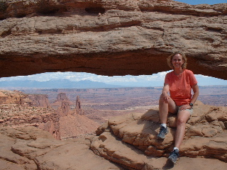
Our final stop in Canyonlands was Mesa Arch. This is also a brief hike, only a mile round trip, but it took us to a spectacular overlook with an arch. Mesa Arch is just past the edge of the cliff and only about 8 feet over the ground on which we stood. However, it is anchored a few feet past the drop off -- so it would be all too easy to slide between the cliff face and the arch to a thousand-foot drop. From the proper angle, two buttes (one containing the small Washer Woman Arch) are visible, framed nicely by the arch and the cliff top. This is one of the more spectacular vistas we've seen.
We left Canyonlands at this point and headed back into Moab for a swim and dinner. Given another day here, we would have liked to visit the southern part of the park. The upper and lower halves are connected only by footpaths and four-wheel-drive-only roads (the latter only accessible when the weather has been dry). By paved road, it's a 70 mile drive from the upper visitors center to the lower.
Dinner was at The Moab Brewery, with more good beer and excellent food. Tonight is an early night, as we head back into Arches on Tuesday morning for a dawn hike to the Delicate Arch before checking out of the hotel and heading up to Park City.