
Betatakin Anasazi Village at Navajo National Monument.
Day-by-Day |
|
| Introduction | |
| Travel | |
| Zion National Park | |
| Bryce National Park | |
| Zion National Park | |
| Coral Pink Dunes, Cedar Breaks and the Vermilion Cliffs | |
| Grand Canyon North Rim | |
| Antelope Canyon and Lake Powell | |
| Navajo National Monument, Monument Valley, and Natural Bridges | |
| Arches National Park | |
| Canyonlands National Park | |
| Arches and the Drive to Park City | |
| Utah Olympic Park | |
| Park City and Olympic Cauldron Park | |
Other Links |
|
| 2002 Winter Olympics | |
| 2001 Europe | |
| 1999 Australia | |
| Home Page | |

We returned to Utah today, driving over 350 miles from Page, Arizona, to Moab, Utah. We left Page and headed northeast to the Navajo National Monument, about 75 miles away. This is a small National Park, with a short hike to an overview of an Anasazi ruin and a longer (4-6 hour round trip) hike to the ruin itself. As we were short on time, we just did the mile hike to the overlook at Betatakin, an Anasazi village that, like many others, was tucked into a hole in the canyon wall, about 50 feet above the canyon floor. Reachable only by ladders, the community had about 100-125 residents.
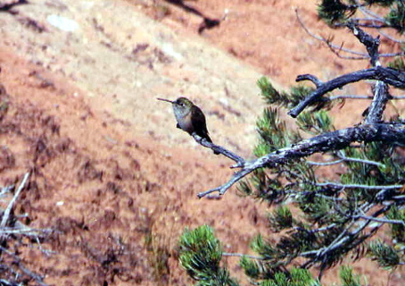
On the way back up to the parking lot, another park visitor pointed out a ruby-throated hummingbird to us. It was alternately feeding on some flowers and sitting, perfectly still, on a small pine shrub. It was a rare treat for us to see one of these birds so close, and so still.
Our next stop was an additional 75 miles to the east, Monument Valley. This is a Navajo tribal park just south of Kayenta, Utah, in northern Arizona. Monument Valley was originally a thousand foot thick layer of rock which has, over thousands of millennia, eroded to leave just a few towering buttes.
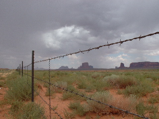
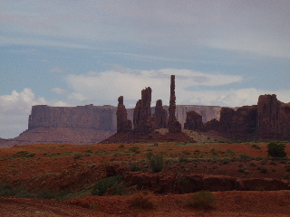
The road is dirt and rutted, but well worth the drive (especially if you're in a rental car!). It's a 17-mile loop that takes about 90 minutes to two hours to circle, including stops at the 11 marked vantage points. Navajo craftspeople sell jewelry at many of these viewpoints. We found "The Three Sisters" and "The Totem Pole" to be the most impressive natural works in the valley.
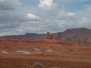
From Monument Valley, we drove back north into Utah in the direction of Natural Bridges National Monument. Our route took us through Mexican Hat, named for a rock structure that looks very much like a sombrero on a person's head.
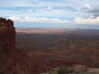
We continued north up the Moki Dugway, a three-mile long "unimproved" (in other words, gravel) climb up a thousand-foot high wall of rock. Suitable for passenger cars and trucks, but not for RVs or anything with a trailer, this climb is truly spectacular. The views to the south over Monument Valley are incredible. Ken was too busy keeping the car on the road to notice the heights.
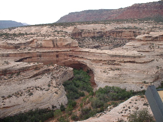
Natural Bridges itself is another small park, but worth more time than we had to devote to it. Arriving just as the lodge was closing at 6:00 PM, and concerned about an approaching thunderstorm, we hurried through the four overlooks (we were not particularly interested in experiencing at first hand the effects of lightning). The walks to the overlooks were all less than a third of a mile, and the hikes down to the natural bridges themselves were not more than a mile, with a trail connecting the bridges on the canyon floor. Our schedule for the day was perhaps a bit ambitious; we wished we had time to take the longer hike into the Anasazi ruin at Navajo National Monument and down to the natural bridges themselves at Natural Bridges.
We ended the day with the last 150 miles of driving up to Moab, Utah. This drive took us through virtually uninhabited spaces and a few small towns. We arrived in Moab at 9:00 PM, checked in at The Gonzo Inn. We went for dinner at Eddie McStiff's, Moab's (and Utah's) oldest legal brewery.