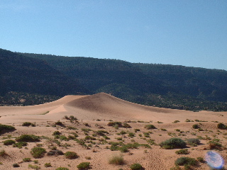
Coral Pink Dunes State Park.
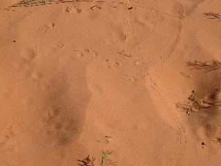
Animal tracks.
Day-by-Day |
|
| Introduction | |
| Travel | |
| Zion National Park | |
| Bryce National Park | |
| Zion National Park | |
| Coral Pink Dunes, Cedar Breaks and the Vermilion Cliffs | |
| Grand Canyon North Rim | |
| Antelope Canyon and Lake Powell | |
| Navajo National Monument, Monument Valley, and Natural Bridges | |
| Arches National Park | |
| Canyonlands National Park | |
| Arches and the Drive to Park City | |
| Utah Olympic Park | |
| Park City and Olympic Cauldron Park | |
Other Links |
|
| 2002 Winter Olympics | |
| 2001 Europe | |
| 1999 Australia | |
| Home Page | |


We had a lot planned for today, so got an early start. We retraced our steps from Monday, heading back across Route 9 to Mount Carmel Junction, but taking US 89 south from there about 12 miles to Coral Pink Dunes State Park. The dunes are formed by winds blowing north across Navajo sandstone, and depositing the sand they erode in large dunes covering 1500 acres of land with sand up to 40 feet deep. Seeing sand dunes in the middle of the rocky Stairways region was quite a sight.
We took a short walk on the dunes and were amazed at the number and diversity of animal and insect tracks we found in the sand. We saw deer, rabbit, lizard, kit fox, bird, and many unidentifiable insect and rodent tracks -- though no actual critters other than lizards. The dunes must be a lively place at night; we arrived around mid morning, and the previous night's activity was evident from the amazing collection of tracks covering every bit of the dunes we could see.
Our next stop was at Cedar Breaks, which we reached by returning north on US 89 to Utah 143, about 30 miles north. The drive along Utah 143 was quite different from anything we'd seen before. It took us through pine forests into a high plateau of grasses.
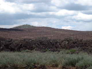
We were astonished to see lava beds along the road -- apparently, there was a great deal of mild volcanic activity in this area between five and ten thousand years ago, leaving jumbled lava beds much like we had seen in Hawai'i during our honeymoon the previous year.
Cedar Breaks (misnamed by early settlers, who took the plentiful juniper trees for cedars), is a canyon similar in size to Bryce, but somewhat less exuberant in its rock formations. We took the Ramparts Trail, which starts at the small visitors center and runs along the rim to Spectral Point. We had some of our most interesting wildlife encounters along this trail. Near the vistiors center we came across a marmot who was quite happily sunning itself within inches of the sheer edge of the canyon. A little farther along, we heard -- and then saw -- hairy woodpeckers searching for insects in dead pine trees. (There was an abundance of such such trees around Cedar Breaks, and for that matter all over southern Utah -- the ongoing drought has lowered the trees' resistance to the bark beetle, which has wreaked havoc on the pine tree population.) While we were watching the woodpeckers, Nieka was surprised by a hummingbird that flew straight toward her, stopping a few feet away; we think the hummingbird mistook her shirt for a flower. The bird seemed just as surprised as Nieka to find the other one there, and retreated to a nearby branch to recuperate.
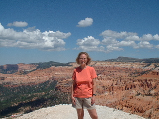
The trail ends at Spectral Point, a promontory jutting into the canyon; it offers wonderful views of the surrounding landscape. It also offered Ken a chance to experience vertigo. Nieka was able to get much closer to the edge than was Ken. Still, Ken thought the views 10 feet from the edge were quite nice.
We returned to the visitors center and the car, and continued our way to Page, Arizona. To get there, though, we had to retrace this morning's drive back to US 89 and back past the turnoff for Coral Pink Dunes; wethen continued straight through to Kanab. At Kanab, we headed almost due east along the Vermilion Cliffs of the Colorado Plateau for about 100 miles. Out the left window was an unending series of deep red rock walls; out the right, nothing but rocky grasslands to the horizon and the occasional group of cattle.
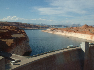
Page, just over the Arizona line, got its start in 1956 as a town for the workers building Glen Canyon Dam. The city is located on top of a mesa just south of the canyon and the dam, and is now a jumping-off point for both the Grand Canyon to the west and Lake Powell. We stopped briefly at the visitors center before crossing the Glen Canyon Bridge and finding our hotel for the night. The dam is an engineering marvel, but caused the flooding of scores of miles of Colorado River canyon (more about this later).
The day ended at Strombolli's, an Italian restaurant where we had barbequed chicken pizza for dinner before heading off to bed.